Lake County
Pablo | Polson | Ronan | St. Ignatius |Flathead Lake Biological Station
Lake County is bordered by Flathead Lake to the north, Mission Valley to the south, Irvine Flats to the west and the Mission Range to the east, and much of the county lies within the Flathead Indian Reservation. The county has the distinction of housing The National Bison Range, the Ninepipe and Pablo National Wildlife Refuges, and Kerr Dam. Surrounded by snow-capped peaks, Lake County offers broad sweeping landscapes, fertile farmlands, and excellent wildlife viewing opportunities.
 |
| (click to enlarge) Figure 3.22: Map of Lake County. Source: Lake County |
As of 2009, the county has an estimated 28,605 residents, making it the ninth most populous county in Montana. The population has increased 8% from 2000 to 2009, mostly attributed to in-migration from other parts of the state and country. A legacy of the Flathead Allotment Act of 1904 and the opening of the Flathead Indian Reservation to homesteading in 1910 is that only about one-fourth of Lake County’s population is Native American—from either the Confederated Salish and Kootenai Tribes or other tribes.
The county’s economy depends significantly on farming, ranching, forestry, local and tribal governments, and tourism. Numerous horticultural enterprises are found throughout the county, including the cherry orchards surrounding Flathead Lake for which it is well known. There are also a number of peach, plum, apple, and pear orchards. Small and home-based businesses add diversity and strength to this generally stable economy. Lake County was officially established as a county in the state of Montana from portions of Missoula and Flathead counties on August 11, 1923. There are two incorporated cities in Lake County, Polson and Ronan, and one town, St. Ignatius.
 Pablo
PabloPablo is known in Salish as
The continual expansion of the independently run Salish Kootenai College and operation of the Two Eagle River School, a secondary education facility also in Pablo, demonstrate a huge commitment to education. The CSKT operate the Kicking Horse Job Corp Center to help young people improve the quality of their lives through career, technical and academic training. The People’s Center in Pablo is a museum established by the CSKT in 1990 to tell the people’s story and describe the way of life as it has passed from generation to generation through exhibits and collections.
 |
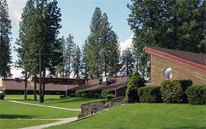 |
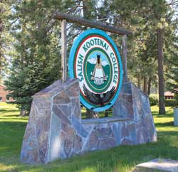
| Figure 3.23: Salish Kootenai College sign. Source: Lori Curtis | Figure 3.24: Salish Kootenai College campus. Source: Confederated Salish and Kootenai Tribes |
The Salish Kootenai College provides quality postsecondary educational opportunities primarily for Native American students from the Flathead Reservation and throughout the United States. With a growing enrollment, the college strives to promote and help maintain the cultures, languages, histories, and natural environment of the Confederated Tribes of the Flathead Indian Nation. Programs include Bachelor of Arts and Bachelor of Science degrees, Associate Arts, Associate Science, and Associate Applied Science degrees, as well as numerous certificate-earning programs. The college houses an extensive library with special collections of historical books about Native American Tribes.
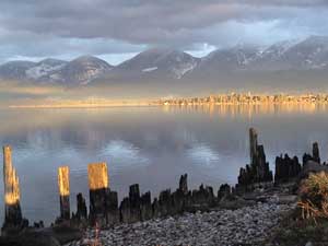 |
Figure 3.25: Sunset glow over Polson. Source: Polson Chamber of Commerce |
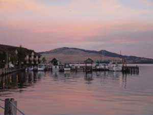 |
| Figure 3.26: Docks at City of Polson. Source: Polson Chamber of Commerce |
Polson
Incorporated on April 5, 1910, Polson serves as the county seat for Lake County. Initially known as the ancient tribal place![]() (meaning head of the water), the beautiful lakeside city has a long history of steamboats, lumber milling, and ranching. The old Port Polson served as the transportation hub for travelers from the south when steamboats played a major role in the transportation of people and freight. The federal government paid to deepen the harbor so ample dock facilities would be available for steamboats serving the growing economic activity on Flathead Lake.
(meaning head of the water), the beautiful lakeside city has a long history of steamboats, lumber milling, and ranching. The old Port Polson served as the transportation hub for travelers from the south when steamboats played a major role in the transportation of people and freight. The federal government paid to deepen the harbor so ample dock facilities would be available for steamboats serving the growing economic activity on Flathead Lake.
In 1918, the Northern Pacific Railroad constructed a branch line from Dixon to Polson, fueling an ongoing discussion about creating a new county. Today Polson has a population of over 5,000 people and an economy bolstered by one of the most fertile farming areas in Montana. This prime cherry growing region is home to dozens of orchards and is the host of the annual Cherry Festival. Retail, health services, light industry, real estate, and government jobs contribute to the economy.
Wood products played in important role in Polson’s history from as early as 1910. For many years it was the home of a softwood mill and a cabinet shop. In the early 1960s, the Dupuis Brothers Lumber was opened by members of the Confederated Salish & Kootenai Tribes. The mill was later purchased by Idaho-based Pack River, the fifth largest privately held timber company in the U.S. at the time. The mill, which employed 250 people at its peak production, closed in the mid-1990s. Polson’s transition from a regional commercial and trade center to a resort community occurred primarily during the latter half of the 20th century. Lakeshore homes were developed in earnest in the 1950s and 1960s, particularly by people from nearby Missoula and Kalispell.
Polson is a very popular summer tourist attraction with many outdoor recreation opportunities and numerous events including the annual Main Street Festival, the Cherry Festival, the Sandpiper Art Gallery Festival, performances of classic musicals and comedies by the Port Polson Players, and the largest car show in the Pacific Northwest. The tourist economy supports fine art galleries as well as quaint shops selling locally produced foods and crafts. Home of Glacier Brewing Company, Polson offers a variety of locally made beers.
The Polson-Flathead Historical Museum displays Polson’s past and a pictorial history of the construction of Kerr Dam. The Miracle of America Museum holds the largest collection of antique artifacts in western Montana. Numerous lakeside parks offer visitors opportunities for relaxation and water sports, while golfers can enjoy the 18-hole Polson Country Club on the shore of Flathead Lake. Kerr Dam offfers a viewing platform, and Polson has a full-service airport with a paved, lighted runway capable of handling small jet aircraft. The nearby National Bison Range in Moiese provides self-guided wildlife tours of bison, deer, and antelope. Established in 1908, it is one of the oldest wildlife refuges in the U.S.
Ronan
Initially known in Salish as Ocqʔétkw (the spring water) and then Spring Creek—after a stream that flows through town and rarely freezes in winter—the name was changed in 1885 to Ronan Springs, after Major Peter Ronan. Ronan was superintendent of the Confederated Salish & Kootenai Tribes for 14 years from 1877 to 1893. The Great Northern Railway brought activity to the reservation in 1883, and on October 4, 1894, a post office was established to handle the increased demand for mail. Ludger C. Tuott became its first postmaster in 1894, and in that same year the name was shortened to Ronan. After a disastrous fire in 1912 that wiped out all but four buildings, the burned-out business owners began to rebuild. The city government was organized that year and E.H. Rathbone was elected as the first mayor. Today, Ronan has about 2,000 residents.
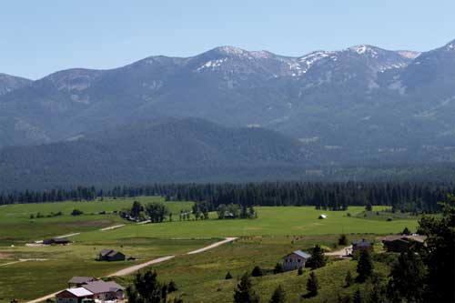 |
| Figure 3.27: Mission Mountain valley. Source: Lori Curtis |
The mountains and rivers in the Ronan area provide outdoor summer and winter activities, and golfers find breathtaking scenery from the Mission Valley Golf Course. Commerce and industry are bolstered by a strong agriculture and wood products base and the Flathead Indian Reservation provides numerous job opportunities. The agriculturally rich valley has been—and continues to be—a trade center for local farmers and ranchers. Modern medical facilities include a newly remodeled, well-staffed hospital and community-built extended care facility. Schools are available from kindergarten through grade 12, with the nearby Salish Kootenai College providing additional courses and training. Birders find numerous bird-watching opportunities at the nearby Ninepipe Wildlife Refuge and Pablo National Wildlife Refuge, where over 5,000 acres (2,023 hectares) of water, marsh, and upland grasses provide habitat for resident and visiting birds.
St. Ignatius
Initially known as ![]() in Salish (a place where something is surrounded), Lake County’s oldest town was founded in 1854 by Jesuit Missionaries, and is home of the St. Ignatius Mission. The Mission, and the town that grew up around it, were both named for the founder of the Society of Jesus - St. Ignatius Loyola. The Catholic priests and nuns that resided at the Mission worked with local Indians to build and establish the first residence school for Indians, first hospital, first saw mill, and first flour mill in the state. The present day St. Ignatius Mission church was built in 1891 and became a National Historic Site in 1973. It is known for its striking interior murals, and while it is open daily to tourists, weekly services are still held in the building. The establishment of the St. Ignatius Mission gave the Mission Valley its name. Some of the valley’s best outdoor recreation opportunities are located minutes from town.
in Salish (a place where something is surrounded), Lake County’s oldest town was founded in 1854 by Jesuit Missionaries, and is home of the St. Ignatius Mission. The Mission, and the town that grew up around it, were both named for the founder of the Society of Jesus - St. Ignatius Loyola. The Catholic priests and nuns that resided at the Mission worked with local Indians to build and establish the first residence school for Indians, first hospital, first saw mill, and first flour mill in the state. The present day St. Ignatius Mission church was built in 1891 and became a National Historic Site in 1973. It is known for its striking interior murals, and while it is open daily to tourists, weekly services are still held in the building. The establishment of the St. Ignatius Mission gave the Mission Valley its name. Some of the valley’s best outdoor recreation opportunities are located minutes from town.
St. Ignatius maintains a friendly, rural feel while offering many of the services found in larger towns. The area immediately surrounding the Town of St. Ignatius is one of the fastest growing in Lake County. This area is attractive for development because of its country ambiance, access to irrigation water, excellent views, clean air, and services provided by the town. Good soils and the extensive irrigation system make agricultural production in the Mission Valley viable. Increased land values and population growth coupled with reduced value for agricultural products, has resulted in a decline of the average farm size, but the area still contains a strong presence of local farmers and ranchers.
Much of the population in Lake County lives outside of incorporated towns. The unincorporated towns include Arlee, Big Arm, Charlo, Dayton, Elmo, Ferndale, Finley Point, Jette, Kerr, Kicking Horse, Kings Point, Moiese, Proctor, Ravalli, Rollins, Turtle Lake, Swan Lake, Woods Bay, and Yellow Bay. These communities and their inhabitants are all part of the rich history of the Flathead Watershed.


